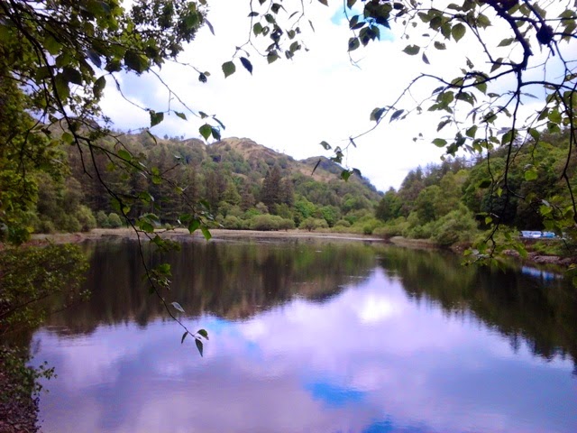
As far as I know Dad did not fish Yew Tree Tarn but I bet he would have wanted to.... It is simply beautiful and is set in one of the countries richest landscapes, the awe-inspiring Lake District. Dad loved the Lake District and often stayed, with Mum, just down the road from The Tarn at the Skelwith Bridge Hotel. He must have driven past The Tarn at some point, I can't for one moment imagine Dad not stopping for a look, especially if there is fly fishing to be had.
The Tarn is a designed landscape and was created in the 30's by the then land owner, James Marshall, who dammed the local Yew Dale Beck to create The Tarn, it consists of an area of open water bordered by beautiful mixed woodland. Strangely I did look for some Yew Trees in the woodland and couldn't find any, maybe I wasn't looking well enough. At this time of year the lush green of the trees leaves are punctuated with vivid hues of the Rhododendron's pink, magenta, lilac, yellow and peach coloured flowers.
Owing to The Tarn's lovely qualities and easy access it is a very popular, and a very well photographed spot.
Yew Tree Tarn is set just off the A593 Ambleside to Coniston Road. There is a handy lay-by in which to park, or a small P&D car park just a little way down the road.
The fishing rights for the tarn are run by Coniston and Torver Angling Association; day tickets are available, Brown and Rainbow Trout are in plentiful stock.
The Tarn is well worth a visit in its own right if you are in the area, but for a longer day out The Tarn is perfectly placed for a spectacular circular walk, the highlight being the stunning views from the summit of Holme Fell.
From The Tarn you make your way along the woodland path to the far end of The Tarn, there is a gated and sign posted entrance to Holme Fell. The first part of the ascent is through Harry Guards Wood. Further on you will find a big boulder and a well trodden path that helps to guide your way. Just a bit further on is an opportunity to turn round and take in The Tarn from your elevated position and the first of the day's inspiring views.... But the best is yet to come!
The next part of the climb up to Holme Fell was through the lovely Uskdale Gap, a narrow but perfect little pass. The best bit was reaching the top, the view that greets you left me speechless; it is truly stunning!
Even though Holme Fell isn't one of the highest Lake Distinct Fells, standing at 317m, it's position makes for a breathtaking panorama of the neighbouring fells.
Wainwright notes that there are some 37 fells in view from Holme Fell summit. The notable ones starting from the SW: Coniston Old Man, W: Wetherlam, NW: Bowfell, Glaramara, Langdale Pikes, N: Silver How, Helvellyn Range, NW: Fairfield range, Loughrigg, Red Screes, High Street range, Wansfell and Black fell.
The true summit of Holme Fell is surrounded by four separate crags: Raven, Calf, Long and Ivy. From these crags you get an amazing and almost unobstructed view of the iconic Coniston Water.
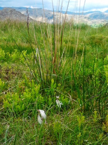
On a Botanical front there is a good crop of hardy Bilberry plants (Vaccinium myrtillus) and Cotton Grass (Eriophorum gracile) on Holme Fell.
Once you have finished having fun hopping about the crags and drinking in the heavenly landscape you proceed towards an unused reservoir that is clearly present in the lower parts of Holme Fell.
The reservoir is the most magical and beautiful secluded body of water I think I have ever seen, as I stood there, the sunlight danced on the water.
A path takes you through a wood and to a style by a National Trust sign. Over the style and on toward the disused slate quarry.
The quarry is home to the most dramatic body of water of the day, a very deep pool has formed at in the bottom of the slate quarry pit. The sheer sides and precarious edge make it quite dizzying to look into.
The path/roadway then leads to a little hamlet, Hodge Close, with the sweetest Lakeland Cottages that are ever present in the area.
The legendary clean air and high moisture levels of The Lakes leads to an abundance of mosses and lichen on a large number of structures, like this wall, a perfect little micro landscape. I did look for a four leaved one, but alas there were none.
The path takes you on a route with a little beck and beautiful open views across the valley and onto Stang End another sweet little hamlet and farm.
The path then guides you along a roadway to the next dwelling place, High Park Farm B&B and Tea Garden, a good brew stop with superb views. High Park Farm is on the Cumbria Way, if you take the path that runs to the right hand side of the farmhouse you will be taken beside an open meadow and towards a woodland path. As you walk along you will become increasingly aware of the sound of water, the fifth, and loudest body of water of the day, The Brathay, and specifically Colwith Force.
Colwith Force is hugely dynamic and deafening and has a strangely alluring quality... Don't worry I resisted a dip, I didn't want to get My Dad's Boots wet!
Beyond The Force the short path takes you to a style, onto a small lane that winds up to the main road (A593) at Colwith Brow. Be careful as you walk along this road it's busy! Eventually you are given a opportunity to step off the road and use a field edge pathway which continues to take you on toward Yew Tree Tarn. Some of the fields had some woolly residents, Not Yew, but Ewe....
There is an additional section of path over the road towards Tom Heights that you can join at Oxen Fell High Cross, not one for today but certainly noted for the future.
When you arrive back at Yew Tree Tarn you arrive by a little beck and bridge, onto a wooded glade where the gated entrance to Holme Fell is. If you bear left you will come out into an area of grass/marshland with a lovely little stepping stone path.
As you round the corner you are again treated to a fabulous view over Yew Tree Tarn.
In summary I am overwhelmed by the sheer beauty of this walk and the lovely surprises found around every corner. I shall most definitely be visiting here for many years to come, as Mum and Dad did at Skelwith Bridge Hotel. My Dad would have loved this walk. I think his seal of approval came in the form of the glorious sunshine, dry and warm weather I, and The Boots, enjoyed. Simply stunning!
Before I sign off I must give a heartfelt Thank You to Phil Taylor, my dear friend, mountain man, Wainwright devotee and Lake District fanatic for all his amazing support, help, great advice, knowledge, encouragement and guidance. Great stuff!
Off to polish My Dad's Boots, see you soon.... MDB x


A great blog. I hope you walk many more miles in the Lakes and remember your dad with love :)
ReplyDeleteThank you Sherran. I intend to cover lots of miles in Dad's Boots and I'll definitely be back to the Lakes soon.
ReplyDeleteGreat post - katie!! You really seemed to be enjoying that place! All the pics are looking wonderful.
ReplyDeletePosted by: Caitlyn | Lake District Hotels
Hi Katie, I came across your blog today via a 'Save Stickle Tarn' petition email update and enjoyed viewing a couple of your walk descriptions and will read more in the coming days. I also love the outdoors and since taking early retirement a few years ago I have walked in the Dales, Yorks Moors and my favourite area, the Lake District. I would love to follow in your and 'your Dad's' footsteps on this walk and probably others I will read about in the future. Would it be possible for you to mark the routes you take on the map photos which you add to the blogs? In my humble opinion, a useful addition too, would be to number the photos and to add those numbers to the route marked on the map, which will show where the photos were taken and help those who would follow your routes to find the places where you took them. Indicating where you parked too would be a great help for those of us relatively new to walking in the beauty of nature. :-)
ReplyDelete