About My Blog


ABOUT MY BLOG

My Dad David died 10.09.13 aged 69. He had a huge love of the countryside. He loved walking and was a keen angler. I was desperate to find and own an object that summed Dad up, after an insightful conversation with a friend, I remembered his walking boots. This set me thinking... How about stepping into them and going for a walk somewhere with a body of water (sea, river, lake, canal, pond, tarn...) and stunning, just as Dad would have wanted.... Here I go in 'My Dad's Boots'

Wednesday, 30 July 2014

The Lake District - Rannerdale Knotts and Crummock Water

This month's MDB walk gave me a perfect opportunity to view three of Lakeland's finest fishing waters, Buttermere, Crummock Water and Loweswater, all within a 360° panoramic view from the summit of a perfect little Lakeland Fell. The other treats of the day included the most awe-inspiring and dramatic fell scenery, which started as I drove there. I was also able to bag my second MDB Wainwright, Rannerdale Knotts and take in a circular walk of the larger of the three Lakes, Crummock Water. I'm unsure if Dad ever came here but I do know Dad would have loved this place, in the true spirit of MDB I know Dad was enjoying every minute of the day with me too. The photos I have taken look as though they have been taken on different days, the weather in The Lakes, being as it is, started off cloudy and drizzly, developed into a beautiful sunny afternoon and then on to a glorious evening full of magical light.


I started the day by parking at the base of Rannerdale Knotts in a little free Car Park, behind a wall, near Hause Point. There is a larger alternative parking place at Cinderdale Common. Once I had pulled on MDB and set myself up for the day I walked only a few yards to find the well signposted path at the base of Rannerdale Knotts. 


The path is fairly steep to start and it takes you straight up a well trodden path. Roughly half way up you are faced with a section of scree, to the right a narrow and very steep path takes you on further. The third part of the ascent involves a steep banking and rocky outcrops. 


Then you reach the summits. There are two, a lesser one and the true one with the cairn on top. As you climb up you are treated to glimpses of the panoramic delight that awaits you on top.... Once you make it to the summit it does not disappoint! Buttermere and Crummock Water


Loweswater in the distance and Crummock Water


As with Holme Fell on my last Lake District MDB visit these fells may not possess the stature of their better known larger neighbours but the views they afford are truly knock out. Wainwright was rather taken with the southeasterly view at the far end of Buttermere; this view offers ten principle fells, from left to right, High Snockrigg, Honister Crag, Fleetwith Pike, Brandreth, Green Gable, Great Gable, Haystacks, Broad Crag, Kirk Fell, High Crag and below it all Warnscale Bottom. Haystacks being, in my opinion, the most notable as it was one Wainwright's favourites. All told you can view 23 fells from the summit of Rannerdale Knotts.


The descent takes you on a longer, greener, less steep path, through bracken, along Low Bank towards the village of Buttermere via High House Crag. 


When you reach the road in the village you walk a little way along and take a right at the Bridge Hotel just over the Mill Beck Bridge. Walk on a short way until you see a path to the left of the most aptly named Pub on a MDB walk 'The Fish'.... I didn't stop this time, but later in the day I did return.


This path takes you across the small strip of agricultural land that divides Crummock Water and Buttermere. At the end of the path there is a lovely little stone bridge, Scale Bridge, that spans Buttermere Dubs. A view from Scale Bridge back toward Buttermere Village is well worth a backward glance.


Take a right once over the bridge and this is where the circuit of Crummock Water begins. The path is a rough and inconsistent all the way round, but this is to be expected in these parts. Along the path you pass over a series of little foot bridges. A view back of Fleetwith Pike.


The whole way along the western side of Crummock Water the looming Mellbreak flanks your left hand side. Wainwright commented on the undeniable synergy between Crummock Water and Mellbreak. 


Appropriately, in this environment a Rowan or Mountain Ash (Sorbus aucupaira) grows well by a foot bridge at the base of Mellbreak.


Over Crummock Water.... Left to right, Lad Hows, Whiteless Pike and Rannerdale Knotts in front.


High Ling Crag and the peninsula of Low Ling Crag, with it's calm beach to the left and it's choppy beach to the right.


Low Ling Crag calm beach to Rannerdale Knotts. 


Rannerdale Knotts is a constant feature the whole way around.


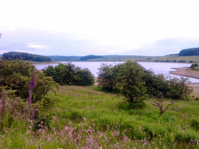
The beaches at Low Ling Crag are not the only ones. The little remote beach at the head of Crummock Water is simply perfect. 


The Pump House, Whiteside and Lanthwaite Wood in front. 


Over Park Beck looking toward Grasmoor.


The path continues through Lanthwaite Wood and a series of lovely little pebble beaches, where the water was lapping gently upon the shore. 


The Boat House and Loweswater Fell.


Continue along the path heading toward Rannerdale Knotts. 


Eventually you end up, back on the B5289 Rannerdale to Buttermere Road at Cinderdale Common. Walk along a short way along the road, being aware of the local Herdwick Sheep as you go.


Wow.... What a remarkable walk. A truly wonderful day out. I'm sure Dad would have heartily approved, especially with my final move back to 'The Fish' in Buttermere for some well earned refreshment! 


This, I know will not be the final MDB outing to The Lake District, there are plenty more fishing Lakes, and some Tarns to be visited.... Oh and MDB Wainwright number 3! Best get MDB cleaned up. x

Map: Bing and Ordnance Survey

NB: Ta Phil!


Saturday, 28 June 2014

The Forest of Bowland - Stocks Reservoir and Hodder Circular

Dad lived with three females; Mum, my Sister and me, even our cat and dog were of the feminine persuasion so he was seriously outnumbered. He loved us all immensely but often needed a handy nearby escape and Socks Reservoir, located in the upland area of The Forest of Bowland a designated Area of Outstanding Natural Beauty, fitted that bill perfectly. Stocks offers fishing, hills, wildlife, a well signposted 8 mile circular walk and most importantly tranquility all the things Dad loved about this place and the reason he visited very regularly. As I drove there it made me smile to think of Dad driving these familiar lanes probably feeling frazzled as he arrived, and refreshed and renewed as he left. 


I started this walk from Dad's favourite, Hollins Bay at the the Stocks Fishery Tackle Shop and Cafe car park, it is a free car park but please avail yourself of the light refreshments at the Cafe http://www.stocksreservoir.com/ . The alternative and more popular starting point for this walk is from the P&D car park at School Lane over the other side of the reservoir. Stocks Reservoir has a plentiful supply of Brown, Rainbow and Blue Trout, and a range of season, half and full day tickets are available from the Tackle Shop.


I started the route by taking the path in front of the Shop and Cafe, this path leads down to the reservoir jetty and the bank-side path. 


The walk doesn't simply take you around the banks of the reservoir but it takes you up into the beautiful Hodder Valley. The Hodder is a river that flows from Bowland's White Hill and flows for 23 miles and is one of the River Ribble tributaries. The Hodder was also regularly fished by Dad. 


The path continues to take you higher up towards the hills and through fields, you soon loose sight of the reservoir as you venture along up the valley. Most of the sheep filled fields are also, at this time of year bedecked with fabulous foxgloves (Digitals purpurea). A series of neglected and broken drystone walls and fragments of old hedgerows make for interesting features on this landscape.


The path takes you further up into the valley towards The Hodder. 


The Hodder further downstream from the crossing point.


To help you over The Hodder there is a wonderfully well constructed footbridge. 


Over the bridge, make your way up the other side of this steep sided valley. 


At the top you will find some lovely and well deserved views of the neighbouring hills.


A disused and rather derelict building, an old farmhouse, can be found as you walk on. I did enjoy idea that it would make a perfect renovation project if someone's lottery numbers came up. The views from the farmhouse are stunning.


The walk takes you back in the direction of the reservoir.


The route guides you through some lovely wooded areas, part of the much larger Gisburn Forest. 

Through the forest, along the path edges you might notice a small, beautiful and exotic looking plant growing.... It is the Wild Orchid (Dactylorhiza).  This plant is a Wild Flower and is protected under The Wildlife and Countryside Act 1981, so wonder in its absolute beauty but please leave them be. 


The path then leads by the School Lane car park, bird hide and picnic area.


Over the causeway you go. This roadway allows you to pass over the 'Bottoms Beck' inlet as it enters the reservoir. 


Then into another area of mixed woodland. When you have leave the wood you walk over fields and enjoy the open views of the reservoir and its lovely little island.


The route takes you across Hammerton Mere and on to the Dam Wall and the 'Valve Tower' at the south easterly end of the reservoir. 


The path takes you up onto the road you drove on, follow this back to Stocks Shop and Cafe car park, and one of their brews! 


So glad Dad had this place of refuge! It's proven to be an interesting and surprising walk as it didn't feel like you were simply navigating around a body of water but adventuring up towards the hills, along a valley, by a river and through a forest. I was glad to see so many men, like Dad, gently unwinding and de-stressing on the banks or out in boats while lost in the fabulous art of angling whilst enjoying the stunning Bowland scenery. 

You will need a copy of an OL41 map to help you navigate this walk. There is a free accompanying leaflet available from the School Lane car park and a number of online guides if you fancy giving this one a try, including this one: http://where2walk.co.uk/yorkshire_dales/riverside_walks/a-circuit-of-stocks-reservoir/

Map: Bing and Ordnance Survey

Well that's me and My Dad's Boots in need of a dry out and rest.... See you soon. 

In addition.... following my Yew Tree Tarn and Holme Fell MDB Walk last month I was honoured to get a mention on the wonderfully inspirational Lakeland Cam, a brilliant daily online photographic journal kept by the very talented Tony. Check it out if you haven't discovered it yet http://www.lakelandcam.co.uk/. Warning, you'll soon get hooked. Ta! 
Related Posts Plugin for WordPress, Blogger...